Canadian photographer R. John Knight shares the stories behind some of his nature and wildlife images


Sunday, December 12, 2010

To Stop and Photograph a Big Black Bear, or Not?


While coming down the road from Maligne Lake, Jasper NP, last October, we encountered a traffic jam.  There were so many cars and people that it was difficult to see what the attraction was.  We drove up slowly, and then saw a very large Black Bear feeding on Rosehip bushes in the ditch.  The tourists were only a few metres away along the shoulder of the road.  Yikes!

We drove on a little ways, and turned around in a side road, and came back to watch.  It was tempting to get out, but the bear was too close for comfort, and there were so many people and cars. 

Eventually, the bear decided that it had had enough.  It initially climbed up the opposite side of the ditch, and then decided to run between the cars and across the road.

Amazingly, several people ran after the bear as it disappeared into the woods. Other tourists followed.  Comments about being too close and giving the bear some space were not welcomed.  We drove further up the road and turned around, then came back and watched from a distance. 

As more people moved towards the bear, it became trapped between the shoreline of a small pond and a long line of tourists.  The bear didn’t know what to do, but amazingly didn’t show any aggressive behaviour.  After a moment’s hesitation, the bear shot through a gap that developed at one end and disappeared into the woods.

While all of this was happening, I slowly and carefully ventured a short distance laterally from our truck and away from the crowd of tourists.  I took the shots here from a distance of about 20-25 m with a 500mm lens, just before the bear disappeared.


Afterwards, I found myself wondering, as I still do now, whether or not I should have stayed to take these images.  Even though I kept my distance for both my safety and to give the bear space, did I interfere with the bear’s activities simply by being part of the ‘bear-jam’?  Should we have stayed, or just driven away?  It’s a tough question.  It’s one that I will continue to think about.

Monday, December 6, 2010

Is There a Fox, an Elk or a Grouse, in your Rear-view Mirror?

Bull Elk
While visiting Prince Albert National Park last fall, we drove along the north shore of Waskesiu Lake early one morning in search of wildlife.  We paused briefly at the bridge over the Waskesiu River, but didn’t see anything.

As we pulled away from the side of the road, Sherrill did a shoulder and mirror check, and happened to notice a fox running up from the ditch.  We stopped, and watched as the fox came towards us on the other side of the road.

While aware of us, it was clearly intent on hunting.  I jumped out of the truck with my camera and 500mm lens, and managed to get a couple of shots over the hood as it ran past.


Shortly after passing us, the fox saw something in the far ditch.  It stopped, and froze.  I fired off a few more shots, and then paused and looked up to see what the fox was going to do next.  As I did, the fox flew high into the air and launched itself out of sight into the ditch.  A few moments later, the fox reappeared, licking its chops, and continued hunting along the edges of the road.  I had missed the ‘wow’ shot of catching the fox in mid-air on my camera, but his airborne pounce was captured as a virtual image in my brain.

Checking us out
Something moved in the ditch!
Ready, aim ...


... missed launch and capture!!!

M-m-m-m-m good!!!

We slowly followed the fox for another kilometre or so, as he continued hunting.  He stopped several more times to chase and catch something in the ditch or the adjacent woods.  Eventually, he crossed the road and disappeared into the woods.

On the road again!
Boy, that was good!
We headed down the road, and were surprised to find another fox coming the other direction only a few kilometres away.  This time, the fox disappeared into the woods as soon as we were spotted.

We traveled up and down the road a few more times that morning, but did not see the foxes again.  An important lesson from this encounter was to not only have your camera and long lens ready, but to periodically check your rear-view mirror for wildlife.  If Sherrill hadn’t done her shoulder and mirror check, we would have missed seeing the first fox.

Grouse hiding in the roadside grass

Thursday, December 2, 2010

Do Grizzlies, Photographers, Fishermen and Tourists Mix?


In late September 2009, we drove to Bella Coola, west-central British Columbia with the hope of seeing grizzly bears.

After the long drive from Calgary to Williams Lake, British Columbia, we continued west for another 365 km across the Chilcotin Plateau to the top of Heckman Pass (elevation 1524m) in Tweedsmuir Provincial Park.    Here, the road abruptly changed to gravel.  For the next 70 km, the road plunged and twisted down the mountain-side with grades up to 18% and precipitous drop-offs with no guard rails.  Locals refer to this portion of the road as “The Hill”.  It was completed by local residents in 1953 after the provincial government decided that a road to the coast was not feasible. 

We safely negotiated ‘The Hill’, then stopped briefly at Hagensborg and Bella Coola.  Here, we learned that grizzly bears were feeding along the Atnarko River in Tweedsmuir Park.

We parked our pop-up camper amongst several large camper-trucks, RV’s and trailers at the Fisheries Pool Campground.  From there, it was only a short walk to the Atnarko River where grizzly bears wandered periodically along the edges of the river in search of salmon.  The main targets were the old putrefied Sockeye, and fresh Chinook salmon.  They were eating in preparation for winter hibernation.   


One sow with two almost full-grown cubs (yearlings) appeared along the river banks when the males were absent.  The bears stayed primarily on the other side of the river.  This gave us the width of the river as our safety margin.  Occasionally, they would wade or plunge into the river to go after larger salmon.  When this happened, we backed away from the river’s edge to give them space, and to keep a safe distance away.


We had to be on alert all of the time, watching for bears up and downstream, and behind us.  At one point, we lost sight of one cub when it swam around a bend in the river upstream.  When the sow swam towards our side of the river, we quickly backed away from the edge into the woods.  As we did, we wondered what had become of the cub that had disappeared up river.  This was timely because that cub was now heading down our side of the river towards us.  It was time retreat well away from the river.


The bears were clearly aware of our presence, and did not seem to be bothered by us being there, as long as we gave them space and did not interfere with their activity.

As we drove through the day before, we noted yellow tape and closure signs along portions of the Atnarko River.  During the week before, large numbers of photographers and other people converged on the area to view the bears.  Some of these people apparently crowded the bears to get ‘the shot’.  The closure of some of the viewing spots along the river was the result, although everyone did not agree with the action or the reasons.

We were quite happy to be there the week after when things were quieter.  Most visitors respected the bears and gave them space.  Unfortunately, there were exceptions: 
     -  One photographer clearly pushed and crowded the bears  
     -  Several fishermen yelled and threw stones at bears that were in sections of the river
        where they wanted to fish 
     -  Several tourists came to the river’s edge with unleashed barking dogs, flash cameras
        going off, and with wandering unattended kids


Each of these situations was a recipe for an unhappy confrontation with a bear.  Fortunately, the bears tolerated both the good and bad behavior this time.

Can grizzlies, photographers, fishermen and tourists mix?  From our perspective, the answer is yes, if there is respect for each other. 

Most visitors had an opinion about who was causing the problem for the bears, and it generally wasn’t them.  To us, it seemed that everyone has to accept responsibility for their actions.

To save us from ourselves, Tweedsmuir Provincial Park has since imposed new viewing restrictions, and has constructed a viewing stand adjacent to the Belarko boat launch, just inside the western boundary to the park.

If you go, consider the following: 
- Join a tour group to view bears
- Follow the recommended viewing distances
- Don't feed, crowd or harass the bears in any way
- Don’t get between a sow and her cubs, or another adult grizzly
- Be alert for other bears in your vicinity, e.g., behind you
- Don’t antagonize a bear by making loud noises or using a flash
- Don’t look directly into the bear’s eyes
- Leave pets in your vehicle
- Keep your kids close and under control
- Carry pepper spray and bear bangers
- Have an escape route and plan
 

Tuesday, November 30, 2010

Wildflowers, Spruce Needles and Raindrops!


We headed to Waterton National Park in early July with hopes of photographing wild flowers. As we drove south, the skies got darker and rain began to fall.  And then, it rained heavily all night, leaving us to wonder what the next day would be like.

Under heavy overcast skies in the morning, we headed into the Park.  To our surprise, the clouds began to break up.  The early morning light streamed through onto the soggy landscape.  We quickly searched for some wild flowers, not knowing how long the sun would stay out.

On the bluffs near the Park’s administrative centre, we each grabbed a camera and tripod, and ventured into wet knee-high grass and bushes.  While the wild flowers were not yet at their peak, everything was covered in water drops from the overnight rain.  The water drops sparkled in the sun.

Raindrops on Mountain Bluebell
 In the bright sun, however, the rain drops began to rapidly disappear as the water evaporated.  I wondered towards the nearby spruce trees, looking for more wildflowers, and stumbled on the following images which were photographed with a Canon 100mm f/2.8 macro lens.  

Raindrops on grass
Raindrops on Spruce needles
  
What you get to see, when you’re at the right place at the right time, and if you happen to be looking in the right direction, can be simply stunning and amazing.


Monday, November 8, 2010

Canadian Mountain Holidays Announces Photo Contest Winners

This is a quick note to let you know that both John and Sherrill were winners in the September 2010 photo contest sponsored by Canadian Mountain Holidays (CMH).

John

Winner - Best Overall Image 
Lichen on weathered tree trunk
Honourable Mention - Best Overall Image
Rain drops on leave
Runner-up - Best Signature Shot of the Bugaboo Mountains
Stormy day in the Bugaboos
 Sherrill
Winner (Tie) - Best Out of the Clouds
Through the clouds
Runner-up - Best Overall Image
Wet leaf patterns in the rain
Honourable Mention - Best Signature Shot of the Bugaboo Mountains
Mountain reflections
Check out the on-line gallery that were submitted by all participants.  Despite the cold and wet weather, everyone was able to capture some spectacular images.  The workshop provided an excellent opportunity to see a variety of terrain, and to meet other photographers

Note that CMH will be offering a Wildflower Photography Workshop at the Bugaboos, August 5-8, 2011 with John Marriott.

Waterfall and stormy weather

Sunday, October 17, 2010

Stranded in Bella Coola With Rising Flood Waters

Well, we're home after being away for 3 weeks.

We had headed towards Bella Coola on Sept. 22nd to join some photographers at Chilko Lake to photograph grizzlies for a week.  At least, that was the plan.  However, 'mother nature' intervened.

Since we had arrived in the area a couple of days early, we drove down 'The Hill' to Bella Coola, just as the rain started. 

We stopped at Hagensborg, a few kilometres east of Bella Coola, for gas and a few groceries late Friday afternoon.  It was here that we learned about the significant storm headed our direction.  We hunkered down for the night at a local campsite, not wanting to try driving back up 'The Hill' in the dark, but planning to leave first thing in the morning.

It rained heavily all night.  When I looked outside in the morning, there were large ponds of water in the campsite, and the road back to the highway was under water.  And, there was no water for the toilets or showers.

We quickly had something to eat, then drove through ~20 cm of quickly flowing water back onto Highway 20, and headed east.  We didn't get far.  A flagman was standing in the middle of the road.  The road was washed out just around the corner, and there were apparently about 14 other washouts between Hagensborg and the bottom of 'The Hill'.

Surfing with our Tacoma and pop-up camper
We headed back the other way, past the campground turnoff where water levels were already noticeably higher.  The accesses to the gas station and local store were flooded, and the road to Bella Coola was under water and impassable.   We were trapped with rising water all around us.

Highway 20, Hagensborg
House in Hagensborg
I checked our GPS to locate road access to higher ground.  It turned out to be at the local high school in Hagensborg.  We parked there for most of the day while it continued to rain, and the rivers and streams flooded.  Periodically, we drove out onto the highway to see if anything had changed.

About mid-afternoon, a local invited us to their house for tea.  A few hours later, however, the road to their house was under water, and threatening to be washed out by the rapidly moving water.  So, with the threat of being cut-off, we helped these people load up a few things, mainly food and clothing, and we headed further up-valley and up-slope to an empty house that was on well-water.  The owners were working in Vancouver.  This is where we stayed, safely above the flood for the next two days.  We slept in our camper, and shared our meals and cooking with our new friends and hosts, Stewart, Shirley and Marilyn, their four canine pals, and friends, Mike and Clare.  While this was happening, Stewart headed off to work on the local roads and clearing culverts of debris with other road crews.


Olsen Road Wash-out, Hagensborg
By late Monday, the rains had eased off and the flood waters began to recede.   With the water turned back on in Hagensborg Tuesday afternoon, albeit with a 'boil order', we helped moved our hosts move back into their home.  The flood waters did not wash out their road, but had come to within ~20 cm of the main floor of their house.  Fortunately, they had no basement, but the crawl space was full of mud and water  Their workshop/business building had been flooded by about 1.5 m of water, judging from the watermarks on the walls, and was now loaded with water-sodden items and about 10-15 cm of wet silt.

Tire tracks in muds deposited by flood.  Heavy shoveling!
Since we had not been in touch with any of the local authorities, we registered with the RCMP and the emergency staff at the Central Coast Regional District office. We were able to confirm that the only road out of Bella Coola would be closed for at least a month, if not longer.  There were apparently kilometre sections washed out by the 200-250 mm of rain that had fallen.

We learned that Tweedsmuir Travel was trying to organize a ferry with the BC government to evacuate stranded visitors like ourselves.  The seasonal ferry that serves Bella Coola twice a week during the summer had just gone into dry-dock mid-September for its winter maintenance.

For the next two days, we retrieved and re-stacked firewood and other items that had floated away, and shoveled silt from buildings and basements at our host's place, and at some of their neighbor's nearby.

Grader repairing undercut road edges


Road and bridge washout, Hagensborg

On Wednesday evening, we heard that we were on a list of possible evacuees the next morning.  The plan was to get us to Bella Bella aboard a small ferry, the Nimpkish, so that we could catch the southbound, Prince Rupert to Port Hardy ferry, the Northern Princess, Thursday evening. 

We were up and out the door early on Thursday to make the drive down to Bella Coola.  Work crews were busy everywhere repairing washed out and undercut roads.


Bridge approaches washed out
Road to bridge undercut by flood waters
At the ferry, we were initially told that our pop-up camper was too tall for the ferry.  It was, after all a 'really small' ferry with a capacity of only 13 vehicles, of which only three could be taller trucks, trailers or campers.  To make a long story short, we did get on.  They had us back on, and with some jockeying around, we put the nose of our truck in under the area for cars.  

We left Bella Coola about 0900 with mixed feelings.  Part of us wanted to stay and help, but we were extra mouths to feed, and food supplies were getting low in the community.  When we heard that other ferry evacuations might be uncertain during the following week, we decided that it was best to take the opportunity and leave.

Nimpkish
Tacoma and camper squeezed onto the Nimpkish
Pack'em in!
Northern Explorer, Bella Bella
By 2230 Thursday evening, we were in Port Hardy, but we were still wondering about how our friends were doing back in Hagensborg.

The Bella Coola flooding was the worst on record for the community, i.e., with 309 mm of rain falling within 36 hours, the river came up 4 m.  Roads and bridges were washed out.  Homes were flooded; some washed away.  The damage was extensive.

Almost three weeks later, the only road to the outside is still being repaired (re-constructed).  Limited essential traffic can use the road under escort.  It will be months before it is properly fixed.  In the meantime, food and fuel comes in by barge.   As if this were not enough, grizzlies and cougars are now wondering through the community in larger than usual numbers as they forage for food to replace the salmon from the annual run.
 
Yes, we missed our week to photograph the grizzlies, but there will be other years.  Obviously, this is where we were meant to be this year, and by being there and through helping others in need, we met some truly amazing and courageous people.

After escaping to Vancouver Island, we stopped to visit our daughter and son on the way home.  Being touch was family after such an experience seemed really important.  Our trip to coast and back turned out to be more of an adventure than we had planned!
 
Bella Coola at sunrise
For more images of the Bella Coola flood, visit Mike Wigle's gallery at:

Friday, October 1, 2010

Yellowknife In February - A Moment of Winter Madness?


Canadian Shield east of Yellowknife
We could claim that we took a wrong turn, or that we ignorantly followed the directions offered by our GPS.  The truth is that it was mid-February in Calgary, and while most people find themselves thinking about sunny beaches far to the south as an escape from winter, we found ourselves craving for some ‘real’ winter. 

One moment, we were wondering what to do.  The next, we were asking our son about Yellowknife this time of year, and our daughter about the best kind of vehicle for the roads up north.  A week later, we were heading North in our truck.  When our son heard about our decision, his comment was, “That was fast!”

As with any winter driving, we packed for the cold, but still wondered about how cold it might get and about driving conditions.  We also wondered if it might be too cold to overnight in our camper, and whether or not we would see the Northern Lights.

North of Grande Prairie, we drove into dense pockets of ice fog, and passed by hoar frost encrusted trees and fences.  As we crossed into NWT, the roads were partially snow covered, and heavily snow-covered black spruce sentinels lined the highway’s margins.  The winter vistas were beautiful.
 
Farm, northern Alberta
Gray Owl, High Level, AB
Near Fort Providence, we encountered our first ice-bridge across the Mackenzie River.  It was hard to imagine crossing on the river ice with a truck weighing up to the 64,000 kg posted limit.   With our southern ignorance, we drove at the posted speed limit of 25 kph in our little truck with a pop-up camper which weighs less than 3000 kg.  Later, a local told us that it was okay to travel a little faster with a regular vehicle.

Abandoned mine, Yellowknife
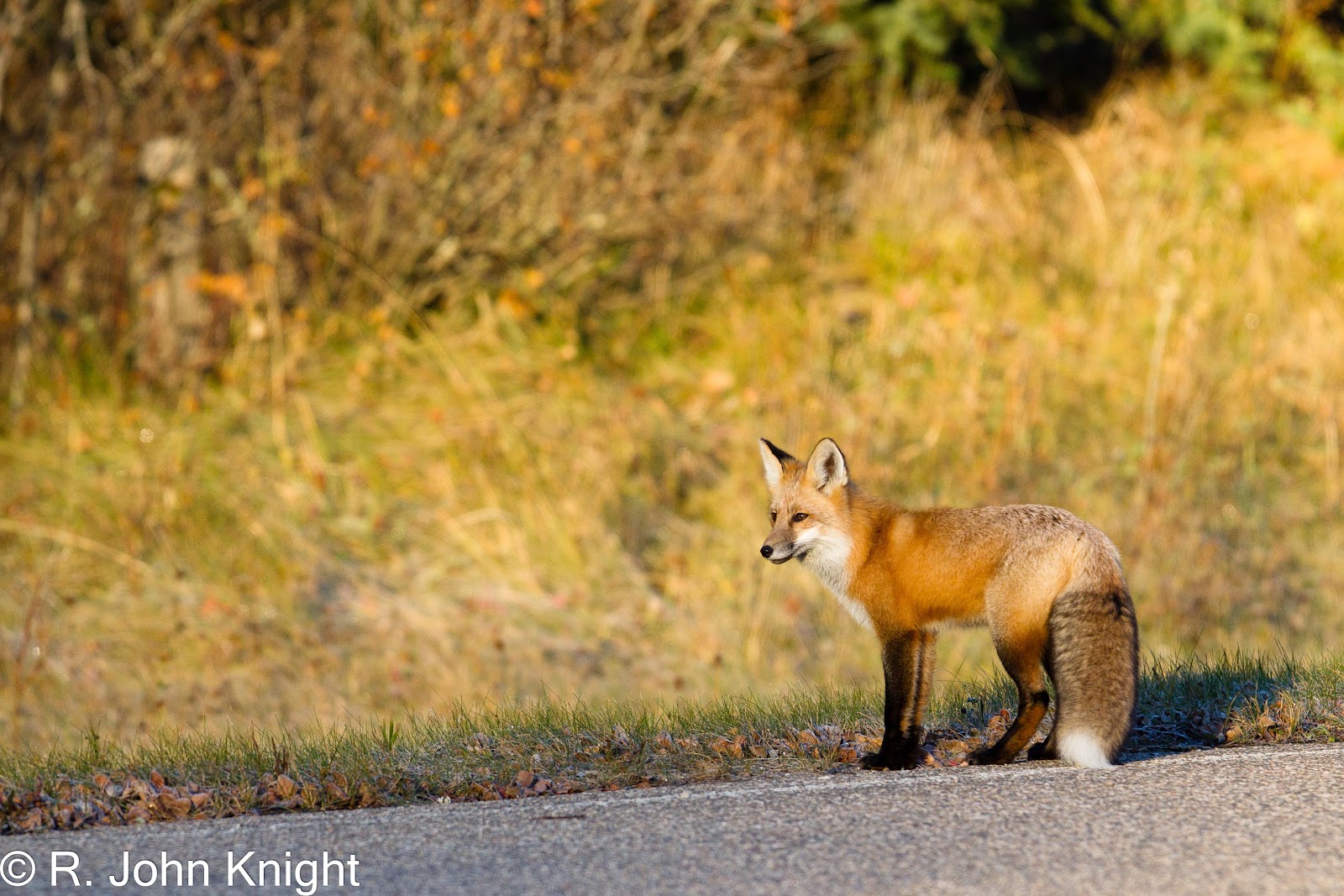
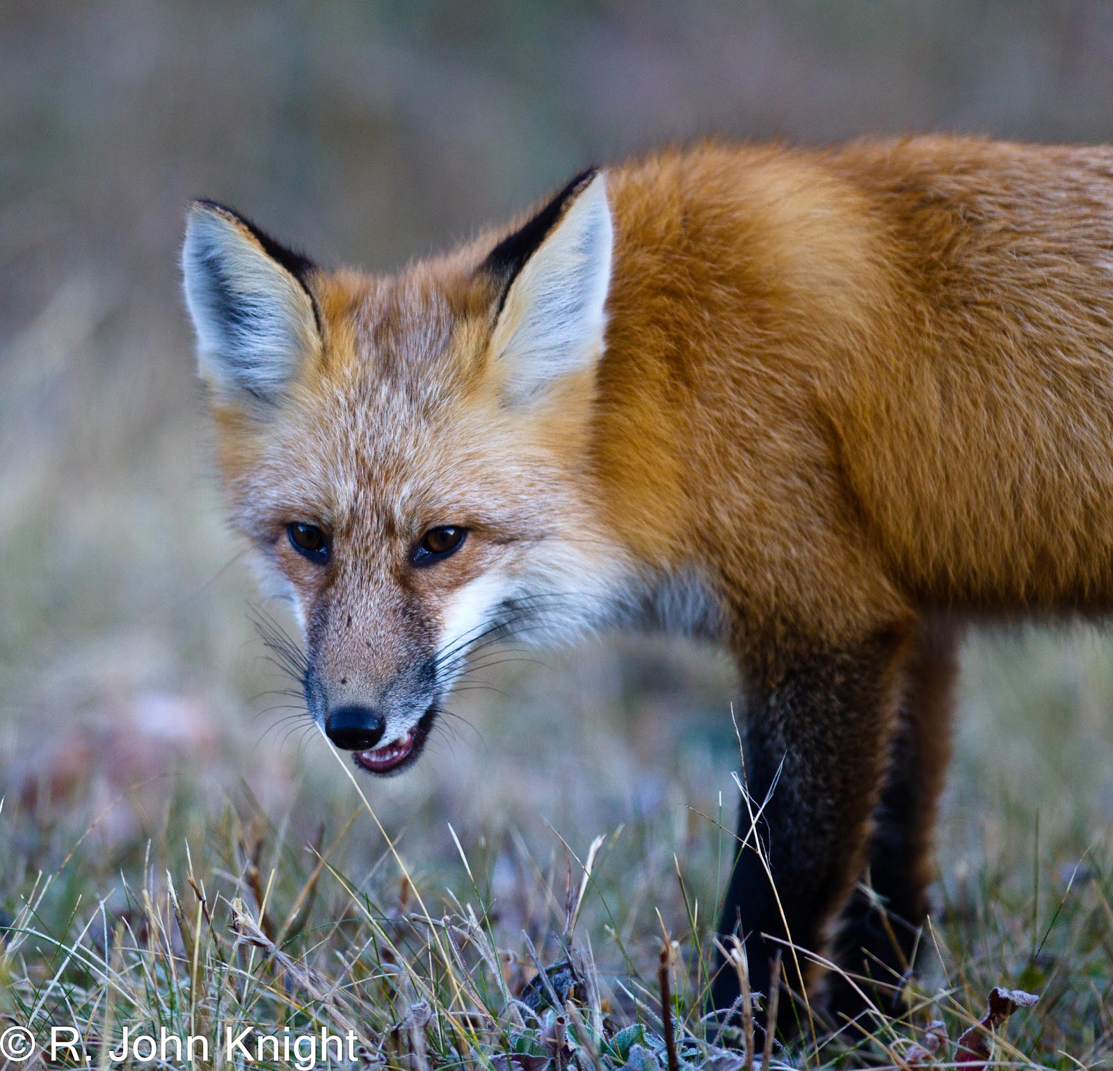
Lynx at the edge of Yellowknife
At the Visitor’s Centre in Yellowknife, it was suggested that we try the ice road from Yellowknife to Dettah, a winter-time shortcut across an arm of Great Slave Lake.  With weekend traffic, the ice road felt like an ordinary country road during the winter, except that the road was on ice.
 
Ice-road from Yellowknife to Dettah
We drove to end of the Ingraham Trail, and watched the trucks head onto Tibbitt Lake where the ice road to various diamond and old gold mines further north begins.  It wasn’t until we saw the truck traffic that we appreciated the magnitude and significance of the thousands of truck loads, mostly double tankers, driving up the ice road.

Start of ice-road at the end of the Ingraham Trail


Large truck heading south on ice-road
In town, we learned that we could drive on the ice roads, at our own risk, as long as commercial trucks were given the right of way, and if we carried our own fuel.  We wanted to try the ice road, and hoped that we might see some caribou.  After traveling about 100 kms on the ice road and across nineteen portages, we eventually saw about 40 caribou in the distance at the north end of Gordon Lake.  Then noting the time of day, and our remaining fuel, we decided to turn-around.  On the way back, we saw two smaller groups of caribou, one of which was fairly close to the road.
 
Woodland Caribou
The ice road effectively followed the same route that canoeists would paddle and portage during the summer.  Driving on the ice road was like any snow-covered winter road elsewhere with some exceptions.  One, the road was on lake ice, not ‘terra firma’, leading you to wonder about ice thickness and water depth.  Two, we were sharing the road with big, heavy trucks that were spaced about 500 m apart, traveling at posted speeds that ranged from 15-25 kph depending on ice thickness and size of the lake.  If you were standing on the ice when a truck went by, it was a little unnerving to hear the ice creak and groan, and to feel the ice bend beneath your feet.  It was difficult to imagine being able to stay on the road during white-out conditions.
 
Driving on the ice-road
With warmer than normal winter temperatures, maintenance crews were flooding portions of the ice road to sustain and enhance the ice thickness.  Driving on these freshly flooded ice rinks required finesse particularly on the corners. 

From the looks on the faces of many of the truckers, they seemed amused to see someone like us on the road. 

After returning to Yellowknife, we headed west to Fort Simpson, Fort Liard and back south with fond memories of our mid-winter trip to the North.  We did overnight in our camper, and the Northern Lights were spectacular.  Travelling the ice road with the truckers gave us a better appreciation of their work, and of the importance of this winter lifeline to northern communities and businesses.

When we got home, we felt that we wanted to do the trip again, but that will have to wait for another winter.  And, we hear that there are more ice and winter roads to explore!
 
Aurora Borealis