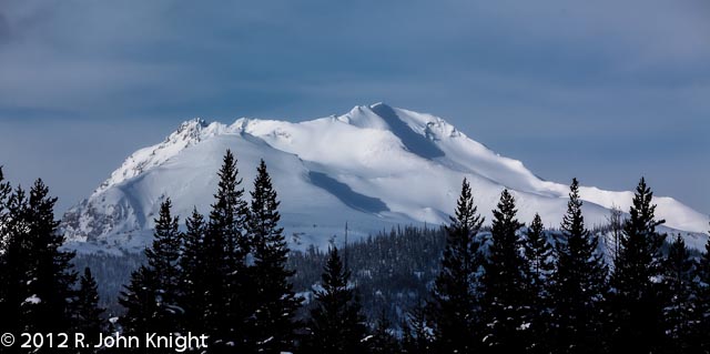
On the way home from the Yukon, we came south from Watson Lake along Hwy 37, instead of returning via the Alaska Highway. To make our journey more challenging,
we did the section between Dease Lake and the Yellowhead Highway 16 three
times with the hope of getting some sunshine and interesting light to
photograph the spectacular snow-capped mountains.
 |
| Location Map: BC's Stewart-Cassiar Highway #37, Watson Lake to the Yellowhead Highway. Source: http://www.stewartcassiar.com/trip-planning/maps/ |
Although the snow-covered roads were generally plowed and sanded, both the weather and road conditions made driving a challenge at times. This part of British Columbia receives about 6 m of snow each winter
 |
| Large snowbanks with no shoulders to pull off. |
We spent 3 days heading south, back north, and finally south with hopes of getting more than overcast skies and snow squalls. When the sun finally shone for a new moments here and there, the views are fabulous, but tough to capture because:
- Hard to get clear vistas without some kind of foreground, so lots of tree silhouettes
- Few places to pull off onto the shoulder of the road during winter with the huge snow banks; some up to 2m in height
- Lots of logging and mining truck traffic
- Off the road, the snow was really deep!!! I went in to my waist several times when I wasn’t expecting to.
Nevertheless, I'm glad that we persevered. I could have spent a week cruising back and forth along the road, looking for the perfect shot. We're looking forward to traveling along this road during late August - early September sometime in the future.


